In January, this year I departed Dunedin on an expedition led by the team from Toitū Otago Settlers Museum to the southwest inlets of Fiordland –Taiari (Chalky Inlet) and Rakituma (Preservation Inlet). I was invited to provide insight as a naturalist on the trip. It would be fair to say that both my expectations of what I would see in this remote part of New Zealand and my excitement levels were high.

Map of Preservation and Chalky Inlets. Sourced from Land Information New ZealandCC-BY 4.0.
Going into remote Fiordland
The trip set off from Dunedin early on Saturday morning. Packed together in a van, our bubble discussed the worry we had all been sharing: that a change in COVID-19 protocols would cancel our adventure, it seems funny now looking back but this was a very real concern at the time. But lucky for us, our fears were unrealised, and we were all virus free. Arriving in Te Anau, we weighed our bags, gear, and food before loading everything into the helicopters. Then we were off.
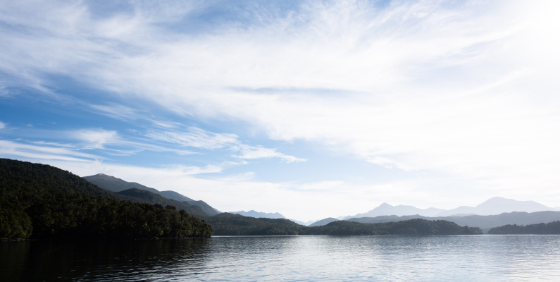
The chopper carried us over Lake Manapouri, crossed the Main Divide and continued towards Supper Cove in the upper reaches of Dusky Sound.Our home away from home, the Tutoko II, was waiting for us there. Once the first crew had quickly unloaded and their helicopter left, our pilot expertly guided us into place and landed the helicopter the back of the boat. We headed out towards the coast, stopping only briefly to fill up the freshwater tanks at Cascade Cove.

Looking across the Main Divide of the Southern Alps to the West Coast.
Seabirds along West Cape, Fiordland
Once out on the open ocean and traveling southwest down the coast, there was much to see. The westernmost point of New Zealand, West Cape, was a hotspot for several species of birds. Poised with my camera in a rolling swell, I took aim at any that came within reach of my lens and quickly set about filling in my seabirder bingo card. We saw white-capped mollymawk (Thalassarche cauta), tītī (Ardenna grisea), fairy prion (Pachyptila turtur), white-fronted tern (Terna striata), and the southern royal albatross (Diomedea epomophora). I watched them feeding and soaring across the tops of the waves, happily distracted from the queasy feeling that accompanied the large ocean swells.

White-capped mollymawk on the wing.
Surprising geography of southernmost Fiordland
My first thought about the geography of the coastline between Dusky Sound and Chalky Inlet was the same as that shared by Dr James Hector in a report that he wrote in 1863: how flat the area between Dusky Sound and Chalky Inlet was. When I think of Fiordland, the classic Tourism New Zealand images come to mind: dramatic northern fiords dominated by steep, glacier-carved mountains that rise out of the ocean. There are near-vertical cliffs on the coast south of Dusky Sound, but inland of these the entire area is dominated by gentle slopes that are covered in smooth round weathered valleys and low hills for some distance until the mountains rise behind this rolling peneplain.

Flat landscapes with mountains rising behind them, as seen from the Puysegur Point lighthouse. Shelter from the wild, open waters.
After a couple of hours of riding the open ocean swell, the 100-metre-high white cliffs of Chalky Island appeared. Upon entering the Chalky Inlet, it became obvious why these nestled waters were sought after by early explorers and sailors for safe harbour.

The white cliffs of Chalky Island, like a beacon, signal safe harbourage from the wild waters of the Tasman Sea.
These inlets and sounds are such good harbours because of how glaciers have carved long, deep channels through the landscape. These deep channels provide many small coves and headlands that offer ideal opportunities to shelter when the weather turns poorly, as it often does in this part of the country.
Legacies of history in the landscape
Although this area of New Zealand feels remote these days, during the late 19th and early 20th centuries, spots like Chalky and Preservation Inlet were visited much more frequently. The link to that forgotten history is what the expedition hoped to explore.

Wreck of the GSS Stella, the government-owned lighthouse steamer that is wrecked in North Port, Chalky Inlet.
The first historical site we visited was the wreck of the GSS Stella. The Stella was a schooner-rigged steamship that was owned by the New Zealand government and was used to transport supplies to the keepers stationed at lighthouses around the coast. This ship often took naturalists into remote parts of New Zealand, so I was enthusiastic to visit North Port, where the Stella lies along the shore of Little Island. The remarkably well-preserved remains of the hull that was first acquired for New Zealand government use in1876. After marvelling for some time, I left the historians to do their work and went exploring the natural surroundings.
Looking for signs of life
Amongst the granite rocks, just above the high tide line, I went looking for Amaurobiidae spiders. Much to my surprise, I found one under the third rock I checked! Amaurobiidae spiders are a beautiful glossy black colour and have attractive chevron markings on their abdomens.

After being hurried back onto the Tutoko II, we turned to our next historical mission: finding the remains of Andreas Reischek’shut. A notable Austrian ornithologist and contentious figure, Reischek spent five months during 1887 in the bush with his friend, Mr Rimmer, and his ever faithful and intelligent dog, Caesar. We were using an old archaeological report to find what remained of their camp and hut. Since the writing of that report, the clearing that was key to finding the site had entirely grown into a full canopy of trees that were almost 10m high. After walking the length of Fisherman Bay, we found evidence of a hearth site and the perimeter of the hut behind the dunes in the bush.


Left: Frank van der Heijden and Ron Bull exploring Fisherman Bay, looking for what is left of Reischek and Rimmer’s Hut. Right: Frank and the remains of the foundations and hearth of the hut.
During Reischek and Rimmer’s stay here they were “driven mad by the incessant sandflies” (these are actually blackflies, but that is a blog for another day). At times when they worked, they were forced to run away from the small creatures as there were so many of them biting them that one could not help but temporarily go mad trying to escape. The sandflies here were (and still are) tenacious and incessant beasties. Reischek writes that at one point he had captured a pair of live kākāpō to take back to civilization. He placed them in a small pen and the hungry sandflies were so intense that he credits them with killing the kākāpō pair overnight.
Interestingly, Reischek noted during his stay in 1887 that rat numbers were at plague proportions around the camp and that he expected the birdlife to suffer as a result. One of the reasons that he was collecting examples of native birds from the area was because there was some awareness that fauna was disappearing from the bush, and extinction was a concern. Despite the remote wilderness and lack of civilisation there today, we did not see any birds. However, there was a significant amount of possum browsing damage and signs of deer. Not the animal traces I was hoping to see in this area that once supported such a diverse bird population.

Thick bush rising straight out of the sea at Otago Retreat.
Abandoned mine settlements of New Zealand’s southern inlets
The next day we made ambitious plans to visit multiple sites: Tarawera mine, Otago Retreat, Puysegur Point Lighthouse, and the Morningstar Mine at Te Oneroa. The dominant theme for this day was mineral extraction and geology. Extractive industries were the primary reason for pākehā occupation and interest in these southernmost inlets, eventually leading to greater settlement there. Here I provide a very brief timeline of the early geological exploration of the Preservation and Chalky Inlets.
-
1773:On his second voyage to New Zealand, Cook’s crew become the first Europeans to notice this area when they sighted the white cliffs of Chalky Island on route to Dusky Sound.
-
1803: Bands of sealers begin frequenting the coastal areas of southwest Fiordland.
-
1822:Captain Edwardson rescued a band of American sealers that had spent 17 months near Preservation Inlet. During this rescue he explored further into Chalky Inlet. He passed a description of the area onto Jules de Blosseville, a midshipman aboard French exploration vessel La Coquille.
-
1826: de Blosseville published a comprehensive map of Preservation and Chalky Inlets, from which many of the Pākehā place names are derived and can be seen adorning maps today.
-
1849 – 1851: The surgeon on the HMS Acheron, Dr Charles Forbes, completed the first proper geological survey of Preservation and Chalky Inlets and noted the presence of the pink granites that formed the ranges, the metamorphic slates, and the coal-bearing sandstones on Coal Island.
-
1863:Dr James Hector visited the two inlets and in the same year provides comprehensive survey reports as part of his geological survey of Otago. However, during this time he was unable to land at Craven Head where gold was found later that year.
-
1873: Dr F W Hutton, the first curator of Otago Museum, then improved on the accuracy of previous reports by noting gneiss, mica, argillite, and clay slates. He provided better descriptions of the coal seams and defined them as being Tertiary in age. He also noted the presence of large glacial erratics (large boulders moved by glaciers and dropped off far from their source) around Kisbee Beach.
-
1887:Andreas Reischek explored the region between North Port and Dusky Sound, discovering several lakes and described other topographic features.
-
1889: Alluvial gold was found in the area for the first time in exploitable quantities, which led to the discovery of gold elsewhere in wider area. Mines were established at Morning Star, Te Oneroa, Sealers Creek and at the Golden Site on the Wilson River. There was a complex gold, silver, lead, and copper reef found in the granite at Isthmus Sound which led to the formation of the Tarawera mine. All these sites prompted a short-lived gold rush and small quantities can still be found if you know where to look.
-
1890: Up to 500 people were mining the goldfields in the area.
-
1896:A detailed report is produced by Alexander McKay, discussing his find of “lower Silurian” age fossil graptolites in the slate-like clays at Cape Providence. These fossils link well with some of the graptolites that are found around northwest Nelson, and there are many shared species with rocks of a similar age in the state of Victoria in Australia.
-
1930: The mining activity ceased after a short, sharp boom. The only remaining inhabitant of the area by this time was the Puysegur Point Lighthouse operator, who noted: “that all the workings are in ruins and all tracks are overgrown.”
The Tarawera Mine
The Tarawera Mine and Smelter site is in Isthmus Sound, Preservation Inlet. To access the site, we ferried to the rocky outcrop, jumped ashore, and climbed up a steep bank to see the remains of the chimney stack running up the hill from the smelter. Strewn around the area were bits of metal which showed the extent of the mining operations. This mine once promised great things with an ore that was rich in silver, copper, lead, and gold. However, it failed to deliver those minerals in quantities that justified the efforts. Wandering around these sites gave me the impression that life in these parts was hard won and when the mines were no longer profitable, they were quickly abandoned.

Remains of the chimney stack of the smelter at the Tarawera Mine site in Isthmus Sound.
Preservation Coal Company
Next up, we headed from Chalky Inlet across to the southern side of Preservation Inlet, past Coal Island to a place called Otago Retreat. Here, there is a small peninsula that sticks out into the narrow inlet and is the location of what was the Preservation Coal Company mine. While looking for the site we saw our first deer, and their tracks made our bush bashing easier. As we neared the mine, we found ourselves climbing down a steep gut, and I noticed some coal in the bank. It turns out the gut was part of an exploratory working of the mine.
We took some photographs of the site and the runway that led down to the beach, where a jetty once sat. We could find no other evidence of it, nor the huts that used to line the beach. The area has a long history of attempts at resource extraction, and there was plenty of coal in the sedimentary layers around the sites of Otago Retreat and Coal Island.


Left: Sedimentary rock on the small peninsula at the entrance to Otago Retreat with Coal Island in the background. Right: Visible coal layers at the entrance to one of the mine shafts that was used by the Preservation Coal Company.
Puysegur Point
No trip to Otago Retreat is complete without a visit to the Puysegur Point lighthouse – especially on a clear summer’s day, when the site is abuzz with bumblebees and the sound of cicadas, and you can see all the way to Solander Island in the southeast.
The original lighthouse at Puysegur Point was built in 1879 but burnt down in 1942. When the lighthouse was rebuilt, all the materials had to be carted 3 km inland from the safe landing site in Otago Retreat. This light house would be one of the last lighthouses to become automated in New Zealand, and the final keeper was pulled from the site in 1990.
Despite being located at one of the most southwestern places on the New Zealand mainland, this lighthouse was the perfect place to observe the rolling, peneplain-like topography that stretches from just south of Dusky Sound to the southwestern-most point of the mainland. This flat coastal area is in stark contrast to that of the dramatic northern fiords of Dusky, Doubtful and Milford sounds, where the mountains seem to rise straight out of the ocean.

The most isolated lighthouse in New Zealand. The Puysegur Point lighthouse.
Te Oneroa
Further into Preservation Inlet, we visited the Morningstar Mine site that sits up behind Te Oneroa Bay. While there is still evidence of the structures that supported the mine, as well as a few cuttings, the nearby historical settlement of Te Oneroa has vanished beneath regrown bush. It was incredible to think that the township once supported up to 500 people.
Kurt Bennett, an archaeological diver aboard our expedition, surveyed the old wharf site that lay off the beach at Te Oneroa, with boats being such an important part of life in these sounds the old wharf sites can provide a fascinating insight into the lives of those who lived here in the past. Kurt was looking for discarded and lost bits that would have sunk to the bottom after being dropped off boats or the wharf itself. The work that Kurt does is important archaeological work as underwater surveys are not a usual form of archaeology due to the complexities of working underwater. While on the beach and waiting for Kurt while he did his survey, we saw and heard the first kākā (a small flock of six) on our trip which was a pleasant way to round off a day searching in the bush for archaeological sites.
Later that night, while moored in the calm and sandfly free site of Isthmus Sound, we spotted a bloom of hundreds of jellyfish at the head of the sound, right on dark. There were a few species present and several kanakana (lamprey) cruising amongst them, looking like snakes in the water.

South Island kākā perched high up in the canopy.
Te Puka-Hereka/Coal Island
The first stop in the morning for us was Te Puka-Hereka, otherwise known as Coal Island. Multiple different mining operations were once conducted there, including the goldmine at Moonlight Point. Now, it is best known as being a predator-free island sanctuary.
The Te Puka-Hereka pest eradication programme was first set up in 2004 as a volunteer-led project. The island was declared pest-free in 2006 and has since had several endangered species of birds released onto it. Upon first setting foot there, the contrast with mainlandis obvious. Instead of silence in the bush and the odd bird being seen, we were greeted on the beach by pīwakawaka (fantails), and the bird chatter was audible before entering the bush.
While the archaeologists were looking at the gold mining sites near Moonlight Point, I was busy trying to soak in the surrounding area and find as many birds as possible. I was overwhelmed by the diversity of species present in an area where all mammals have been removed. It was stunning to see kākā causing a ruckus, brown creeper fluttering around, tītipounamu chirping away, tūī being bullies, korimako brightening the day with their song, kākāriki being ever so hard to photograph, and the mighty, chubby kererū crashing through the trees

Toutouwai – South Island robin hoping to catch any insects that are disturbed in the bush.
Kisbee Bay and giant rhododendron
From the water when cruising about the sounds, everything appears untouched. Lush bush has covered up most signs of human habitation in the area, and the whole place seems extremely isolated. It has not always been this way and these sounds have a rich history of human occupation, first by Māori and then by Pākehā.
One place where the true extent of Pākehā inhabitation can be seen is at Cromarty in Kisbee Bay. When gold was first found near Cromarty, a large fishing and gold mining village was set up here with several lodging options, a sawmill, a pub, and multiple shops. In the forest, its traces are obvious. There are old bottles spread through the undergrowth and lots of bricks about that mark the previous locations of fireplaces or the corners of buildings. By far one of the most interesting sights to see here is a giant rhododendron that was in the garden of the old pub. The tree is absolutely huge and must be a real sight amongst green bush when it is in flower.

Giant rhododendron in the old township that was Cromarty, located in Kisbee Bay.
The pā on the Spit Islands
The Spit Islands, with their two crescent beaches, can be seen from Sandfly point. A marine wonderland, kaimoana is plentiful about their rocks, with kina in tidepools, pūpū (cats eye snails) everywhere, and pāua within easy reach. It is a real insight into what the kaimoana would have been like in the past. As well as boasting abundant seafood, the two idyllic beaches are joined by an almost inaccessible rocky peninsula, making this the perfect spot for a pā site. We explored the area a little, looking for evidence of human occupation.

Blood-red sunset at Cuttle Cove. During whaling operations in the past, this small bay would have turned red with the blood of whales.
Cuttle Cove and the site of the first shore-based whaling station
That night, there was a terrific sunset where the water of Cuttle Cove turned red. It was a poignant reminder of the bay’s history as the site of the first shore-based whaling station in New Zealand. Whales were once brought there from around the sound to be flensed down and processed for oil, frequently turning the water red.
If you want to truly see what lives in the New Zealand bush, and all its little creatures, the night is the time to do it. I wanted to look for spiders and wētā, so headed into the bush at Cuttle Cove to do some entomologizing. The invertebrate activity was low due to the drought-like conditions up there, but I still found a few big spiders, wētā, and harvestmen to photograph.
We spent our second day in Cuttle Cove looking for evidence of human habitation while the divers did an underwater survey. Frank found some whalebone, and we saw the usual signs of historic human life: discarded glass and bits of rusted metal.


Drought in the far south
On average, the weather station at Puysegur Point lighthouse receives 2460mm of rainfall a year which is less than the more northern weather stations at Milford Sound (6700mm annually). Although it gets less rain, it has a higher number of rainy days than fiords further north and is known for receiving little sunshine. Despite predictions that the weather would be poor, the weather during our time in Preservation and Chalky Inlets was mostly sunny, warm, and delightful. Although this made for pleasant working conditions, many of the wetland-like areas were almost caked dry where mud should be prevalent. Plants like liverworts and mosses that only grow in wet areas were shrivelled and dry. The area was in a drought and these conditions were not ideal for looking for invertebrates, so it is not a surprise the full suite of South Westland invertebrates was not on show.

Helm’s stag beetle (Geodorcus helmsi)
Rock art
The next stop on our tour of the sounds was to see a site that likely predates any pākehā arrival in New Zealand and consisted of drawings made in a cave by the tūpuna who visited or stayed here long ago. It was quite the trek to the site, navigating bluffs and a rising tide, as well as seals that were sleeping amongst the rocks. Once we were there, Ron led a small karakia before we entered the narrow slit in the cliff. Inside, the cave walls still displayed the art that was put there by the old people.


Left: Navigating the rocky outcrops looking for rock art. Right: Rock art from Chalky and Preservation Inlets.
There are a few significant rock art sites around the fiords, and we visited two of them during our time in Preservation and Chalky Inlets. The second site is near the old Ordovician-aged sedimentary rocks that can be found at Cape Providence. These rocks contain fossils that are some of the first evidence of multicellular marine life.
After visiting this final site, the weather changed for the worse and the captain of the Tutoko II made the call that a run to Dusky Sound was needed to not get caught in the worst of it. The conditions on the open ocean were extremely poor and most of those aboard felt ill. Reaching the shelter of Cascade Cove was a relief. We remained there until the next day, then moved up to Doubtful Sound, as it was unlikely that we would be able to helicopter out in the poor weather.

Wild weather in the fiords.
Protecting paradise
After visiting places as wild as the Preservation and Chalky Inlets, it has solidified in my mind the importance of the Predator Free 2050 movement. Mammalian creatures that our bush and birds are defenceless against have a massive effect on the environments they inhabit. The bush in this country should be lush and loud.
I have never visited an area before where there was such a pronounced contrast between open, silent bush and noisy undergrowth just a five-minute boat ride away. I would like to encourage anyone who has read this far to reach out to their local trapping organisations and get involved by decreasing the predator load in your backyards. Our birds and our bush need you.

Wet weather just off Cape Providence with William McKee and Kurt Bennett.
A massive thanks to all of those who were on the expedition and the crew from Toitū for inviting me along to participate in this trip of a lifetime! If you would like to know more about this oncebustling place, the ten-part documentary series can be found on YouTube: Furthest Frontier II: Stories from Southern Fiordland
*Promo image: View from Cuttle Cove looking North-East towards Isthmus Sound with the Dark Cloud Range on the left and the Cameron Mountains on the right.